DFW Weather Update: Cold Front Ends Fake Spring, Back to Reality
Summary: North Texas is waving goodbye to the fake spring weather as a cold front ushers in colder temperatures and rain chances. After setting a record high on Saturday, the region is bracing for a significant drop in temperatures and multiple days of cool, rainy weather ahead.
Saturday Record High:
The city of Dallas witnessed a remarkable achievement on Saturday as a new record high temperature was set at DFW. Basking in the warmth of spring-like conditions, the region reveled in the balmy weather before a cold front swept through, signaling the imminent return of cooler temperatures on Sunday.
The Colder Air Arrives:
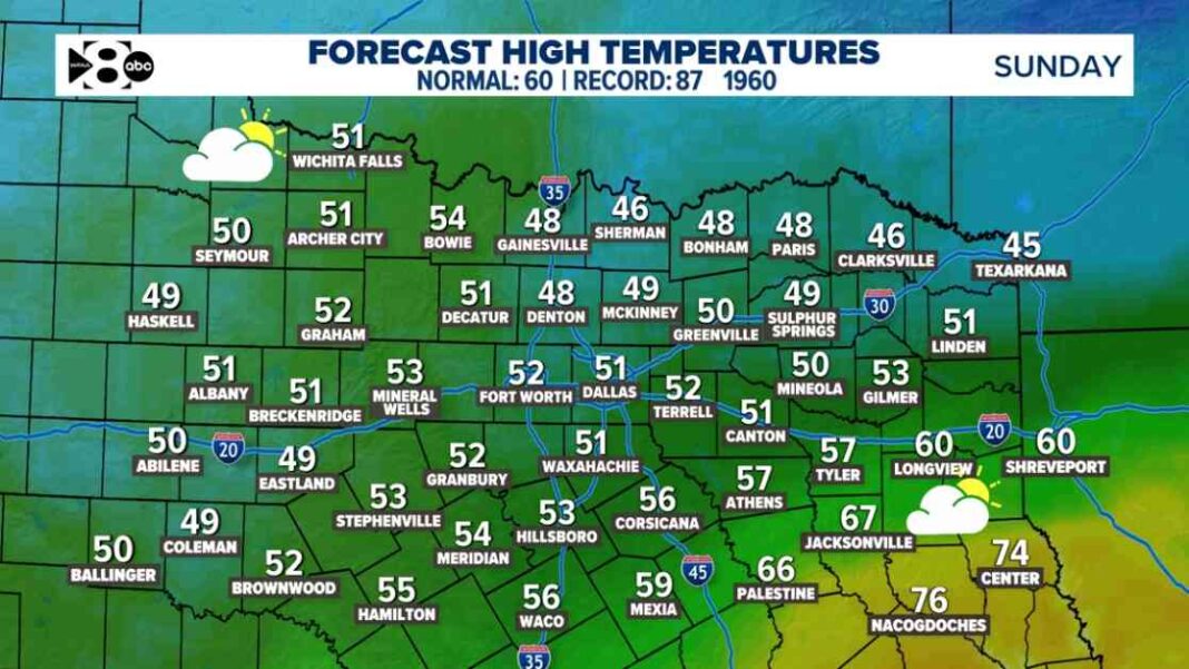
Following the record-breaking warmth of Saturday, Sunday is poised to deliver a dramatic shift in weather conditions. With high temperatures expected to plummet by 35-40 degrees compared to the previous day, residents are advised to locate their jackets as the brisk chill sets in, marking the end of the brief stint of unseasonably warm weather.
Extended Cool Weather Forecast:
While February has seen above-normal temperatures for the most part, the arrival of cooler air signals a prolonged period of unseasonably cool weather in the region. This shift will also bring with it multiple opportunities for rain in the upcoming days. As North Texas braces for the change, the next five days are forecasted to remain chilly, setting the stage for a return to typical winter conditions.
Rainy Outlook for Next Week:
Looking ahead to the upcoming week, North Texas can expect overcast skies and intermittent rain showers. The forecast indicates that Monday night into Tuesday will see the highest likelihood of rain, with another round expected on Wednesday. While the rainfall is not anticipated to be severe or heavy, most areas can expect to receive an average of 0.50 to 1 inch of precipitation.
Monday:
The week kicks off with sporadic drizzles, sprinkles, or light rain showers throughout the day, albeit with low coverage. Overnight into Tuesday morning will see the arrival of a more widespread batch of showers, persisting into the early hours.
Tuesday:
The morning and early afternoon hours on Tuesday are expected to witness widespread showers, tapering off as the day progresses. By the evening, the region should see a reprieve from the rain, with patchy drizzles and light rain resuming overnight, leading into Wednesday morning.
Wednesday:
A rapid-moving disturbance is forecasted to bring light to moderate rainfall across the region, primarily during Wednesday morning. By late afternoon, the system is expected to move out of the area, allowing for clearer skies and drier conditions.
As North Texas readies itself for the return of wintry weather and the accompanying rain, residents are advised to stay updated on the evolving forecast through reliable sources like the WFAA+ streaming app and the WFAA app for real-time alerts and weather updates. Embracing the changing seasons with preparedness and caution, the region is poised to navigate the transition from fake spring to the reality of cooler temperatures and rainy days ahead.


